HOME » PROJECTS » AGRICULTURE » SENSING PROJECT
SENSING PROJECT

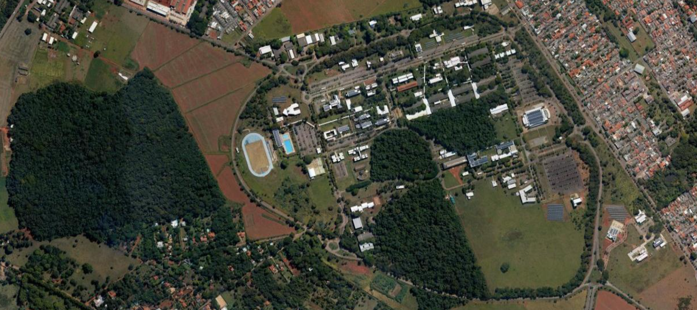
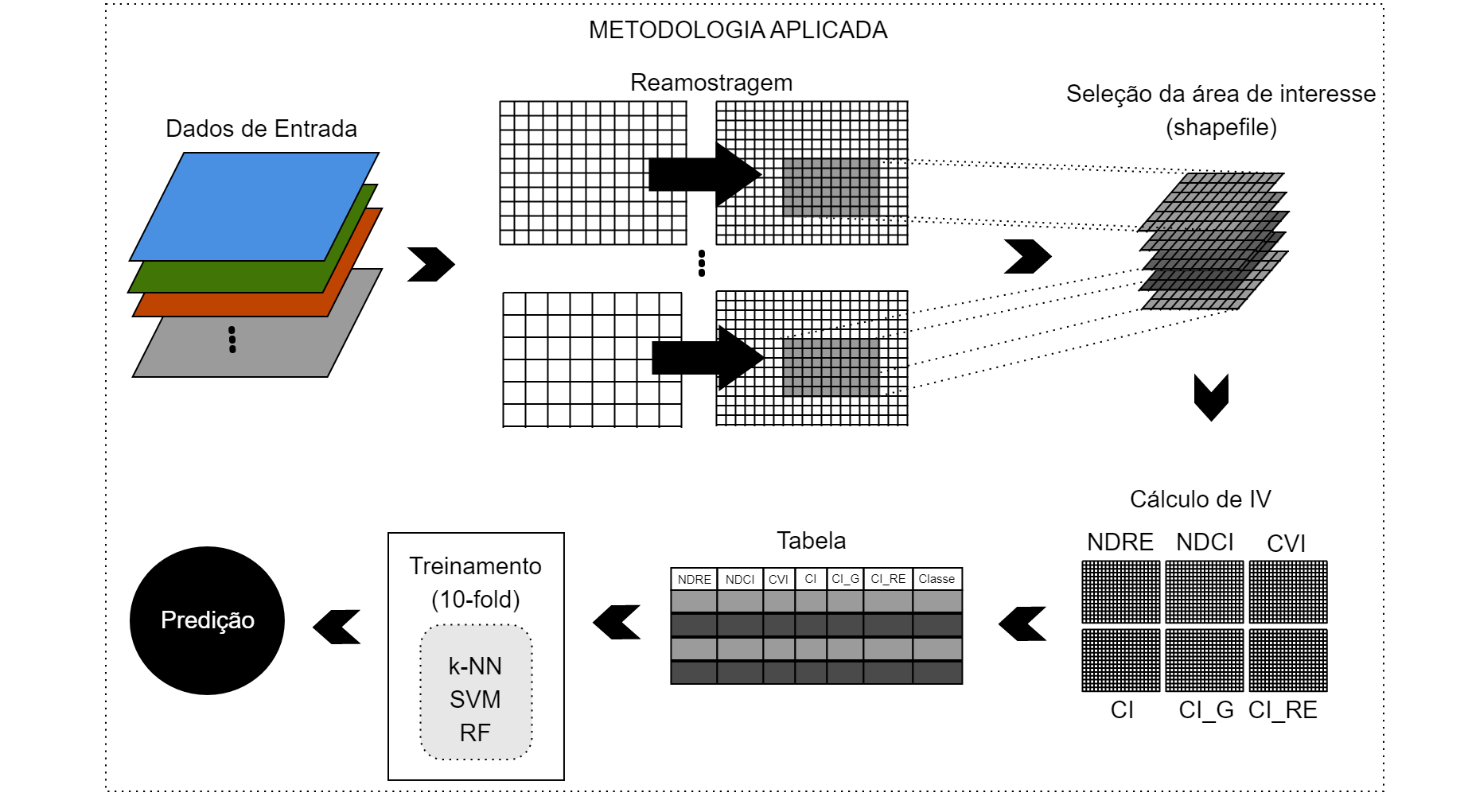
Remote sensing techniques using satellite images are widely applied in several fields of agricultural science. The ease of obtaining a large amount of information in real time combined with the resources offered by deep neural networks have enabled great advances in this field of study.

Methodology

With a special focus on remote sensing applied to the identification of sugarcane varieties, discrimination between varieties is extremely important as it allows monitoring the growth of the crop in terms of the characteristics of each variety of sugarcane.
The methodology applied makes it possible to identify any ground cover. The technique consists of an efficient and fast location of the image on the satellite, performing a resampling, extraction of coverage indices and applying Artificial Intelligence algorithms for classification.

Partners in Sensing Project